Last updated 22 May 2011 |
| Home Page | History | Village Life | Bus Timetable | Parish Church | Parish Council | Local Walks |
|
|
||
|
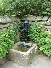
The countryside around Whittington attracts numerous walkers all year round. In due course this page will link to various walks and, where possible, provide photographs and descriptions which may be of interest. We start with the popular walk from Kirkby Lonsdale via Biggins, Sellet Mill to Whittington and return along the banks of the Lune. We have now added a page describing the paths on Hutton Roof. At the bottom of the page there is a link to John Harris's "Walking in Lancashire" Which has the description of more than 130 walks in Lancashire with more useful information for the keen walker. |
||
Page One - Kirkby, Sellet, Whittington and the Lune This popular walk from Kirkby Lonsdale to Whittington and back is well known. In these pages we try to describe the route, for those who don't know it, and have added a few notes and photographs which may be of interest to those who already know the route well. The route map and description, in PDF format, can be downloaded, and printed. Alternatively we have two pages, one a map of the route (with photo links) and the other a description of the route, which can be viewed on this web site. |
||
|
|
||
Page Two - Hutton Roof Hutton Roof abounds with paths and walks. We have tried to describe the access points and typical paths around the Rakes, Balsterfoot Gap and to the Trig point on Dalton Fell. You can probably spend most summer weekends simply investigating the varied aspects of this interesting local beauty spot. And maybe do a bit of North Lancashire Limestone Rock Climbing. The route map and description, in PDF format, can be downloaded, and printed. Alternatively we have two pages, one a map of the route (no photos this time) and the other a description of the route, which can be viewed on this web site. |
||
|
|
||
Page Three - Farleton Fell The area known as Farleton Fell is in fact a number of fells and crags, including Farleton Knott. Very different to Hutton Roof the fells provide a panorama from the Eastern Fells around to Morecambe Bay. Lacking the mass of vegetation, which is characteristic of Hutton Roof, the majority of the routes and paths are over much more open ground. In many ways Farleton is the ideal spot for a light evening stroll, but you can go mountain biking, horse riding, and I have even seen people training hunting birds. The route map and description, in PDF format, can be downloaded, and printed. Alternatively we have two pages, one a map of the route (again no photos) and the other a description of the route, which can be viewed on this web site. |
||
|
Walking in Lancashire More than 120 FREE Lancashire walks to download, details of all the books, maps and walking groups in the county Walking around Pendle The walks are mainly concentrated at present within about 10 miles of Pendle Hill itself, but over time will cover the whole of Lancashire. |